Wicklow Mountains
The Wicklow Mountains National Park begins 25 km south of Dublin — granite moorland, oak valleys, and Ireland's finest upland walking, all in a day.
Glendalough: full-day Wicklow Mountains hike and drive
Duration: 8.5h
- Free cancellation
- Instant confirmation
Quick facts
- Distance from Dublin
- 25–55 km south, depending on destination
- National Park
- Wicklow Mountains National Park — free entry
- Highest point
- Lugnaquilla, 925 m (half a day from Glenmalure)
- By tour
- Most tours depart Dublin 9–10 am, return by 5–6 pm
- Best base
- Roundwood or Laragh for walkers
Ireland’s mountain backyard, 30 minutes from the capital
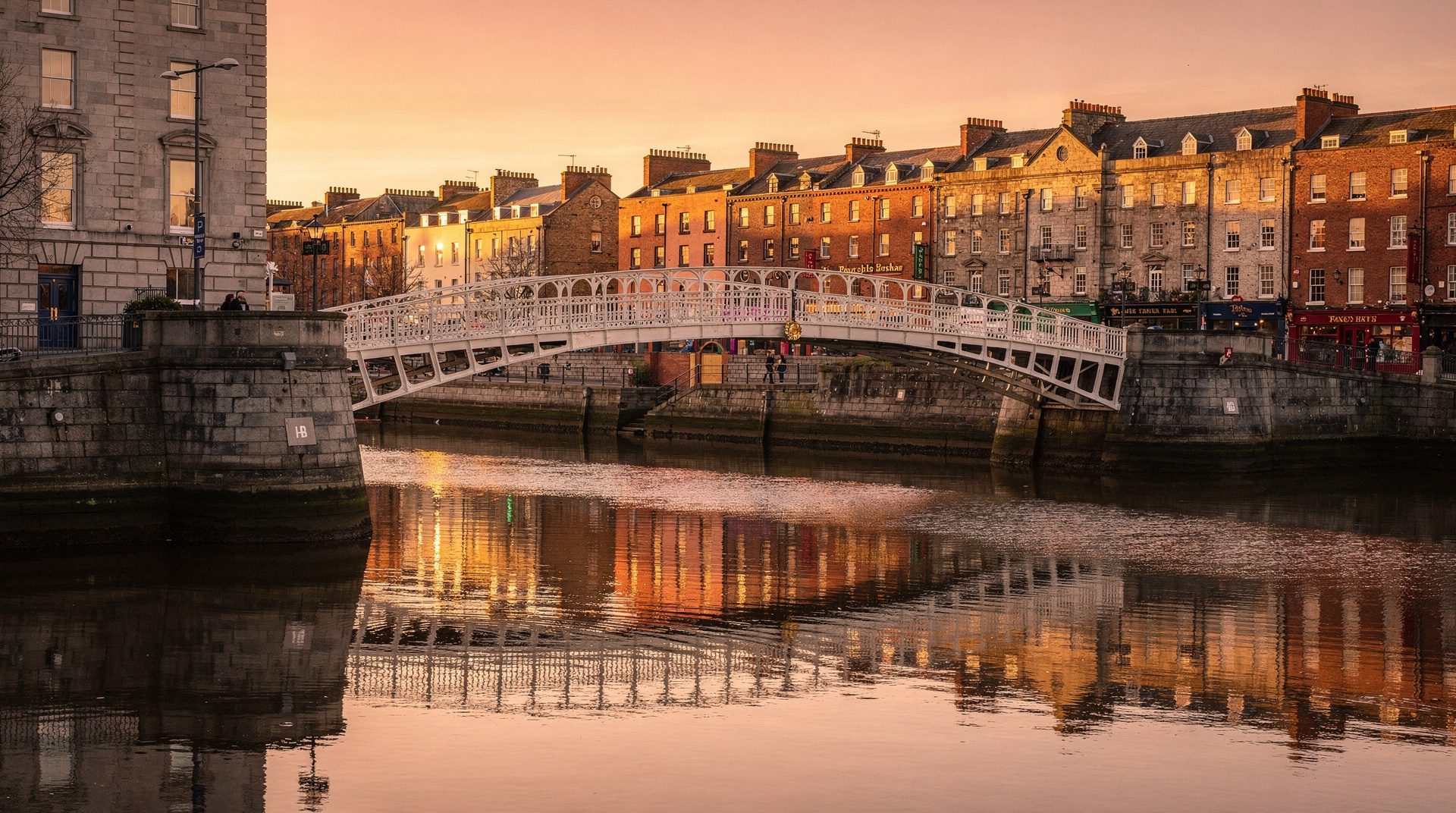
The Wicklow Mountains are where Dublin goes to breathe. The Irish call the range the Garden of Ireland, which is accurate in parts — the valley floors are lush with oak and ash — but the uplands are something rougher: vast expanses of peat bog and heather, shaped by glaciers and battered by Atlantic weather, with granite peaks breaking through where the moorland gives way to exposed rock. It is genuinely wild country by Irish standards, and the contrast with the compact, Georgian city an hour to the north is abrupt.
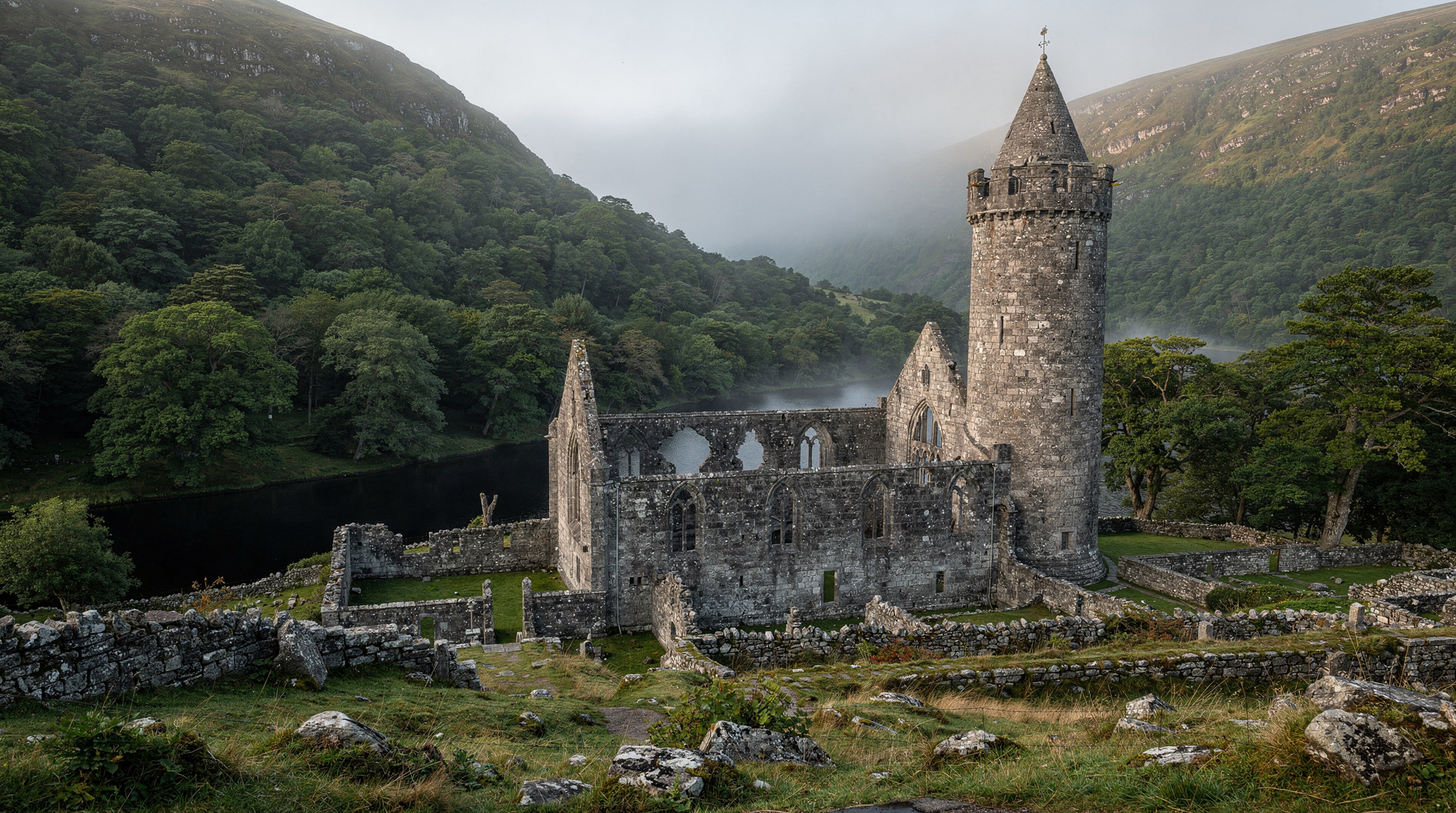
The national park covers 204 square kilometres and contains Ireland’s largest upland area. Within it you will find the monastic ruins of Glendalough, the glacial lakes of the Sally Gap plateau, the formal gardens of Powerscourt, and walking routes from a short lakeside stroll to a full-day ridge traverse. The question is not whether to go to Wicklow — it is which part of it, and whether you go on an organised tour or drive yourself.
| Where | 25–55 km south of Dublin, spanning Wicklow’s uplands |
| Cost | National Park entry free; tours from around €40–70 per person |
| Time needed | Full day; half day if focused on one valley only |
| Getting there | Organised tour or car; no train reaches the uplands directly |
| Best time | April–October for walking; midweek for smaller crowds |
Getting there from Dublin
Most people reach the Wicklow Mountains either by organised tour or by car. There is no train into the mountains themselves, though the Dart reaches Bray and Greystones on the coast, from where you could hire a car or cycle inland. For the uplands and Glendalough specifically, a tour or a private car is the only realistic option.
The Glendalough Wicklow Mountains hike and drive is the best choice if you want to actually walk in the mountains — it combines a guided hike on the uplands with a visit to Glendalough, and allows significantly more time on foot than the standard sightseeing tours. The Wild Wicklow tour is more popular and covers more ground scenically but at a faster pace.
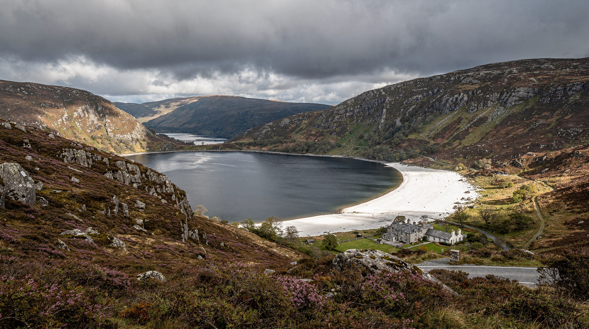
Driving from Dublin takes 45–75 minutes depending on where in the mountains you are headed. The R117 over the Sally Gap is the most scenic route from the north, passing Lough Tay (the Guinness Lake) and continuing to Glendalough via Roundwood. From the south, the N11 to Rathdrum gives access to the Avondale and Avoca valleys.
The Sally Gap and the mountain roads
The Sally Gap is a high mountain crossroads at approximately 500 metres elevation where several blanket-bog plateau roads converge. It is bleak in the best way — treeless, open to the sky, with views across the Wicklow uplands that on a clear day extend to the sea. The road from Roundwood to the Sally Gap passes Lough Tay, the dark-watered lake that drops sharply from the road, which is arguably the single most dramatic view in the county.
This road, the R759, is narrow and requires confidence if you meet oncoming traffic, but it is perfectly driveable and is routinely used by tour coaches. From the Sally Gap you can continue west to the Military Road and south to Glendalough, making a full loop of the most scenic part of the mountains.
Walking in the national park
The national park maintains a network of waymarked walks ranging from a 1-kilometre easy loop to sections of the 132-kilometre Wicklow Way long-distance route. A few worth knowing:
The Glendalough upper lake circuit (about 4.5 km, 1.5–2 hours) follows the wooded south shore of the upper lake before climbing to overlook both lakes from the cliffs above. It is the best short walk on the whole mountain if you are limited for time.
The Camaderry summit (647 m, about 5 km return from the upper lake car park) gives you a panorama of the whole Glendalough valley and, on a clear day, as far as the coast and the mountains of Wales. Allow 3–4 hours for this and wear proper boots.
The Spinc ridge (about 9 km loop from the main visitor car park) traverses a ridge above the upper lake on a boardwalk section before descending through the valley. This is the most rewarding full walk in the park for those with half a day and reasonable fitness.
Lugnaquilla, the highest peak in Leinster at 925 metres, is in the southern part of the national park near Glenmalure. It requires a long approach walk from the valley and is not a casual choice; allow a full day from Dublin and experienced mountain navigation.
| Walk | Distance | Time | Suits |
|---|---|---|---|
| Glendalough upper lake circuit | ~4.5 km | 1.5–2 hrs | Most visitors, limited time |
| Spinc ridge loop | ~9 km | 3–4 hrs | Half-day walkers, reasonable fitness |
| Camaderry summit | ~5 km return | 3–4 hrs | Panoramic views, proper boots needed |
| Lugnaquilla | Full-day approach | 6–8 hrs | Experienced hikers only |
For all walks above the valleys, bring waterproof trousers and a warm layer even in summer. The weather at altitude changes faster than forecasts suggest, and the peat bog is waterlogged year-round.
Wild Wicklow and Glendalough day tourWhy the mountains stayed wild
The Wicklow Mountains’ remoteness is not accidental. After the 1798 Rising, rebel leader Michael Dwyer held out in these uplands for five years, using the terrain’s difficulty to evade capture — the British response was to build the Military Road, which still runs through the range today and remains the main route across the Sally Gap and down to Glenmalure. That history explains why a mountain range so close to the capital stayed so undeveloped: it was designed, quite deliberately, to be hard to move through.
Wildlife and landscape
The uplands support red grouse, peregrine falcon, and merlin. Hare are common on the plateau moorland. Lower in the wooded valleys, red squirrel survive in the older oak woods, and the rivers hold wild brown trout. The blanket bog itself — stretching across much of the upper plateau — is an ecosystem of sphagnum moss, cottongrass and heather that has been accumulating for thousands of years; walking off-path compresses and damages it permanently, which is why the boardwalk sections of maintained trails exist.
Combining with other Wicklow destinations
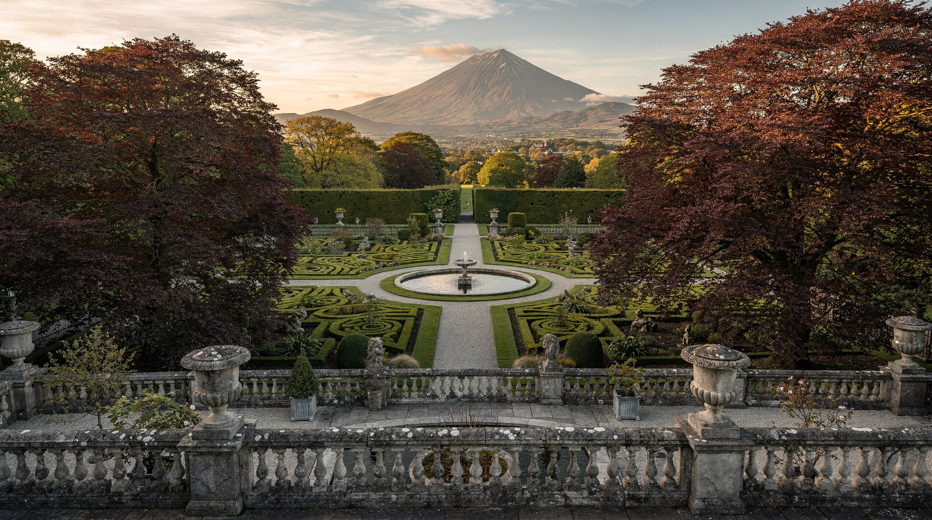
The mountains form a logical hub for a full Wicklow day. Powerscourt sits on the northern edge near Enniskerry, offering formal gardens, a waterfall, and the most photogenic country estate in Wicklow. Avoca in the south offers the Avoca Handweavers mill and the wooded Vale of Avoca. And Glendalough sits at the heart of the mountains, reachable from almost every direction.
The wicklow-glendalough day trip guide maps out the combinations in detail. For families considering the mountains, family day trips from Dublin has Wicklow-specific suggestions for keeping younger children engaged.
When to visit
April through October covers the main walking season, with May and September the sweet spots for weather and manageable crowds. July and August are busiest — the Glendalough car parks can be full by 10 am on summer weekends, and the mountain roads see heavy tourist traffic. Midweek visits in any season are noticeably quieter.
Winter visits are possible but require shorter ambitions — the days are short, the upper plateau can be icy, and some cafe facilities at the visitor centre reduce their hours. That said, the bog under a January frost, with the mountain peaks dusted with snow, is a sight that the summer visitor never sees.
Frequently asked questions
Should I book an organised tour or drive myself? It depends on whether you want to walk. Tours are the easier option for sightseeing — no parking stress, no navigating the R759 yourself — but self-driving gives you flexibility to stop where you like and stay longer on a walk. If you specifically want to hike, choose a tour built around walking, such as the Glendalough hike and drive, rather than a standard scenic-drive tour.
Is a car essential, or can I get to the mountains by public transport? For the uplands and Glendalough, effectively yes — there is no rail service into the mountains, and bus options are limited and slow. The DART reaches Bray and Greystones on the coast, but from there you would still need a car or bike to reach the interior.
Top experiences
Bookable activities with verified prices and instant confirmation on GetYourGuide.

Glendalough: full-day Wicklow Mountains hike and drive
- Free cancellation
- Instant confirmation

From Dublin: Wild Wicklow Mountains and Glendalough tour
- Free cancellation
- Instant confirmation

From Dublin: Powerscourt House, Guinness Lake & Glendalough
- Free cancellation
- Instant confirmation
From Dublin: Wicklow Mountains private day tour incl. Glendalough
- Free cancellation
- Instant confirmation

Dublin: Wild Wicklow shore tour - Glendalough & Guinness Lake
- Free cancellation
- Instant confirmation